NOAA’s ProTech services solution is a suite of multiple-award IDIQ contracts consisting of five Domains: Satellite, Ocean, Fisheries, Weather, and Enterprise Operations. These Domains provide resources in support of NOAA to include its Line and Staff Offices. Where applicable, the contracts may also be used by other Bureaus within the Department of Commerce (DOC). The ceiling dollar amount for all orders under all ProTech Domains is $3,000,000,000.

The mission and objectives of the primary users of the Satellite Domain are related to satellite and observation activities and the collection, preservation, and dissemination of information and services derived therefrom. The National Environmental Satellite, Data, and Information Service (NESDIS) is dedicated to providing timely access to global environmental data from satellites and other sources to promote, protect, and enhance the Nation’s economy, security, environment, and quality of life. To fulfill its responsibilities, NESDIS acquires and manages the Nation’s operational environmental satellites, provides data and information services including Earth system monitoring, performs data and information product stewardship and preservation, develops and produces information products and models derived from observed data, and performs official assessments of the environment and conducts related applied research.
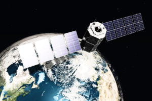
The ProTech-Satellite Domain will satisfy the need for professional and technical services to support the full range of related requirements for satellite activities, including satellite missions, which NOAA manages or in which NOAA participates, and managing the environmental data that results from those missions. NOAA’s environmental satellite data are essential for forecasting weather, analyzing environmental and climate phenomena, and monitoring hazards worldwide. This 24/7 global coverage provides a constant stream of information used in preparation for events that impact our climate, weather, oceans, and daily lives.
Founded in 2002, INNOVIM is a NOAA- and NASA-focused, Maryland woman-owned small business (WOSB) with an emphasis on innovative uses and integration of science, technology, software and systems engineering, and program management—from photons through decision support—including Earth observation, data management, and applications. Indeed, INNOVIM’s very existence is predicated upon the collection, dissemination, and exploitation of environmental intelligence: our commitment to environmental intelligence is, literally, our company mission. A proud NOAA partner for the past 12 years, INNOVIM supports both NESDIS and NWS through multiple prime contracts and subcontracts. INNOVIM is also providing support to NOAA/NESDIS under our Engineering Management Services contract, and to NOAA’s National Weather Service (NWS) across 24 task orders through our OpsTech contract.
INNOVIM assembled a superbly qualified team of support services organizations to provide complementary expertise in support of NESDIS’s satellite science and technology goals, including operations, maintenance, technology enhancement, and new science.
Orbital ATK is a premier provider of space-related engineering services to government agencies and laboratories. As a leader in aerospace and defense technologies, Orbital ATK designs, builds, delivers, and services low-Earth and geosynchronous space systems to customers around the world. Orbital ATK is under contract to design and fabricate the Joint Polar Satellite System (JPSS)-2 spacecraft, with options for -3 and -4, as well as integration of government-furnished instruments, satellite-level testing, on-orbit satellite check-out, and mission operations support. Orbital ATK’s broad experience in satellite design, construction, integration, launch, check-out, and mission operations services make them the perfect teammate to support ProTech tasks relating to NOAA’s satellite systems development and operations.
The Space Science and Engineering Center (SSEC) is one of the largest research centers at the University of Wisconsin-Madison. Housed within SSEC is the Cooperative Institute for Meteorological Satellite Studies (CIMSS), established in 1980 to formalize collaborative research and education with NOAA. Today, SSEC receives data from 22 polar-orbiting and geostationary satellites—data that support international atmospheric research. In partnership with NOAA, SSEC proposes, tests, and evaluates instruments and sensors onboard each generation of polar-orbiting and geostationary satellites—including GOES-R and JPSS—and develops algorithms to transform this wealth of data into environmental intelligence, leading to significant improvements in weather forecasts and climate data. They bring exceptional experience in NOAA’s remote sensing science and systems, as highlighted by their real-time simulation of the GOES-R Advanced Baseline Imager (ABI) for user readiness and product evaluation, and four years of experience acquiring and processing data from the Suomi-NPP satellite as a member of the NOAA Satellite Proving Ground.
a.i. solutions complements the INNOVIM ProTech Team with their systems engineering and spacecraft flight dynamics experience. Over their 20-year history, a.i. solutions supported the design, development, and operations of more than 200 space missions. Their products and services span mission systems engineering, spacecraft ground systems development and sustainment, spacecraft systems engineering and pre-mission analysis, space operations, modeling and simulation, IT infrastructure, launch vehicle engineering, and guidance, navigation and control engineering services in support of the nation’s major space and defense agencies. They are the creators and developers of FreeFlyer®, the widely used commercial spacecraft flight dynamics, analysis, and operations software. a.i. solutions’ continuing support for NOAA’s mission encompasses orbit design, mission analysis, orbit determination, pre- and post-launch support, and attitude determination for NOAA-N, N’, GOES-N through R, S-NPP, JPSS, and the Deep Space Climate Observatory (DSCOVR).
Jeffries Technologies Solutions, Inc. (JeTSI) is a woman-owned small business with thirteen years of exemplary support to their clients including the JPSS Program for five years, NOAA’s Office of Satellite Ground Services (OSGS), NASA’s Goddard Space Flight, Glenn Research, and Langley Research Centers. JeTSI’s systems engineers and architects deliver decades of experience on JPSS, GOES-R, and other US Government and international satellite ground systems, bringing superb science and technology experience with ground system development and operations. They provide comprehensive analysis in support of critical decisions in architecture, systems design, concept of operations, cost analysis and planning, and implementation. JeTSI engineers are proud to be a part of the national team supporting programs such as JPSS and OSGS, providing weather and environmental intelligence. JeTSI Enterprise Architects developed the business and systems models for the current and future NESDIS Ground Enterprise, and the selection of standards to be applied in the Technical Reference Model, guiding future NOAA ground systems.
M2 Strategy has partnered with NOAA to help streamline their organizations, enhance satellite user-readiness, and support their programs across Line Offices. M2 is a Women-Owned Small Business with a noteworthy record of customer service proven by repeat business from 100% of their clients. M2 brings technical, scientific and functional services experience to the ProTech Satellite Domain. M2’s current federal customers, where they provide similar services to those in the Domain, include NOAA NESDIS and NWS, NASA, and the U.S. Army. INNOVIM and M2 have partnered for over three years on multiple task orders in support of NOAA. Additionally, M2 Strategy has over six years of experience providing functional and technical support to NESDIS, specifically the GOES-R Program and User Readiness, to enhance this team’s capabilities.
DB Consulting Group, Inc. (DB) is a mature, small business providing award-winning expertise in the development, implementation, and management of a wide variety of mission-critical information technology (IT) systems for NOAA and NASA. Their NOAA experience is especially relevant to ProTech since they provide management and support of NOAA’s Comprehensive Large Array-data Stewardship System (CLASS), where their eight years of on-the-ground experience gives them a focused understanding of the complete NESDIS IT environment. Assessed at CMMI-DEV Level 3, with ISO 9001:2015 registration, DB’s breadth of experience includes program management, IT security, software and applications development, systems design, development and implementation, enterprise architecture, database and data management, data acquisition and analysis, systems engineering, network support, and training and communications.
